
Denison Previous Residents by Era
A backward address trail changes tools as it crosses a date boundary. The online deed index supplies recorded instruments from 1915 forward, but Grayson County custody begins in 1846 and earlier work may require the counter or archival microfilm. City directories identify households or businesses as printed in particular editions. Census schedules offer household evidence, while maps, newspapers, probate, cemeteries, and narrowly requested permits can test a date or identity. None of these sources alone proves every later conclusion.
| Source | Years it covers | Where held | What it shows |
|---|---|---|---|
| Grayson Official Records online index | 1915-present | County online portal | Recorded grantors, grantees, document data, and legal description |
| County counter and state microfilm | County custody from 1846; deed reels 1846-1886 | County Clerk and TSLAC | Earlier deed books and indexes |
| Denison city directories | Documented editions vary; reported holdings 1887-1992 | UNT, libraries, and genealogy catalogs | Printed household, address, and business leads |
| Federal census | Public schedules through 1950 | Federal census and library research channels | Household evidence, with address detail varying by schedule |
| City permit records | Not stated | City Clerk open-records route | Address-specific physical-work information if maintained |
For a recent transfer, start with the parcel and a recorded instrument. For an early family or occupant question, start with the closest dated directory or census entry and work outward. A date before 1915 is the signal to add the county counter, Texas State Library and Archives Commission microfilm, or an archive to the search.
Denison Records Start the Trail
Use the Grayson Central Appraisal District property search to anchor the modern parcel before looking backward. The card can supply a Property ID, Geographic ID, legal description, situs address, owner name, owner mailing address, tax-year information, improvement and land sections, and a deed-history panel with the last three deed transactions in the sample instructions. The appraisal roll is not title evidence, and it can lag a deed by about 90 days, so save it as a starting record rather than the final answer.
| Owner tab | Owner name, with booklet guidance to use last name then first name. |
|---|---|
| Address tab | Begin with a simplified street number and street name when a full address does not match. |
| ID tab | Property ID, once another source has supplied it. |
| Advanced tab | Owner Name, Street Number, Street Name, Geographic ID, legal-description aids, subdivision, tax year, and other filters shown by GCAD. |
| Result tools | Owner, appraised value, View Details, selected-parcel checkboxes, and View Selected on Map. |
GCAD distinguishes the situs, or physical parcel address, from the owner's mailing address. A mailing address can be outside Denison. Record both labels exactly. If a query fails, remove a prefix, suffix, or unit, then try the Owner, ID, or Advanced tab before deciding that the parcel is missing.
Denison Records in the Deed Index
Once the current property card yields an owner and legal description, the Grayson County Official Records search is the recorded-instrument layer. Its Real Property search accepts a name, subdivision, document type, or document number. The county instructions also support a first-name space last-name format, document number, or volume-page number. Use a date range to narrow a common name. Start with Search Index Only for a clean party and date search, then use Search Index & Full Text when an OCR phrase or legal-description term may help.
The TSLAC Grayson County historical-record microfilm page is the source of this archival index view.
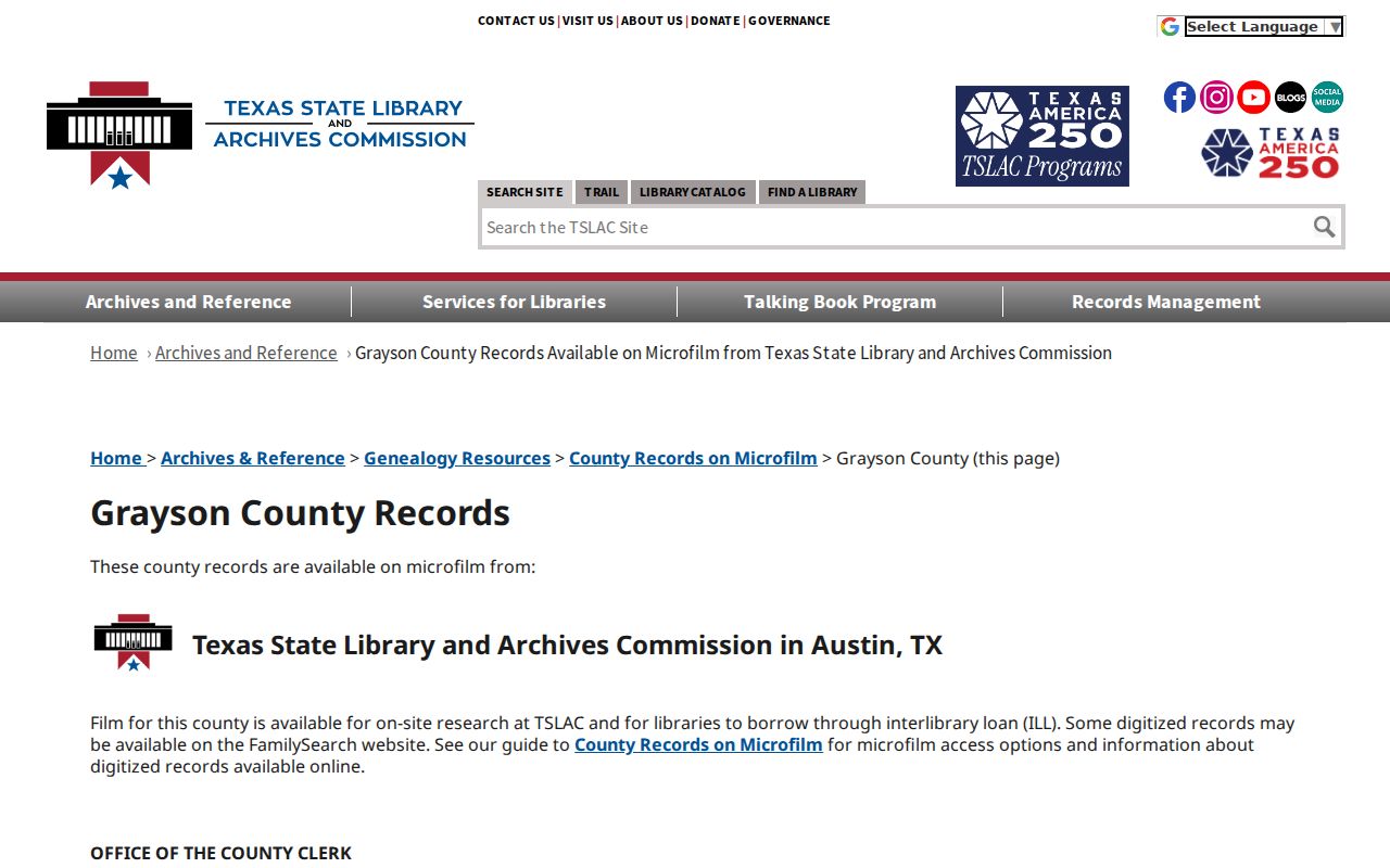
The state microfilm listing is the fallback when the online 1915-present index cannot reach a needed early deed or index volume.
Results can show grantor, grantee, document type, recorded date, document number, book or volume and page, plus legal description. The portal can open a scanned image and add it to a cart for purchase, although the current image price was not located in the research. For older volumes, contact the Real Property counter at the Grayson County Clerk, Ground Floor, Suite 17, 100 W Houston St, Sherman, or ask about the correct copy route at 903-813-4239 or deeds@co.grayson.tx.us.
Tracing Denison Previous Residents
A deed chain is a sequence of instruments, not a field labeled owner history. Follow the current owner to the purchase instrument, then work through the prior party and recording date. Keep each document number, book or page reference, legal description, and date in a separate log. A transfer into a trust, estate, corporation, or group of owners can alter the name pattern without changing the parcel. Likewise, a subdivision can alter the legal wording without creating a new physical place.
- Search GCAD by the address and record the Property ID, Geographic ID, situs, owner, and legal description.
- Search the Official Records index for the present owner and the legal description or subdivision, then identify the purchase deed and its recorded date.
- Read the image when the index leaves the prior party or legal wording unclear. The image can add marital-status language, restrictions, easements, or a fuller description.
- Search the prior grantor and prior date to find the next earlier instrument. Check name variants and all parties rather than assuming one spelling controls the chain.
- When the chain reaches the online boundary, take the document, volume, and date notes to the Clerk counter or the relevant TSLAC reel.
- Grantor and grantee
- The grantor is the party transferring an interest in the recorded instrument. The grantee is the party receiving it.
- Chain of title
- The dated sequence of recorded instruments used to trace interests in a parcel. It is not the same as a list of occupants.
- Legal description
- The lot, block, subdivision, survey, or other formal land description that ties records to the parcel even when street wording changes.
Denison Records When Addresses Change
Street text alone can break an otherwise sound address trail. Legal descriptions can outlast a changed street number, a shortened street name, or a later plat. Use the county GIS parcel, addresses, road-centerline, city-limit, and ETJ layers to keep the place fixed. Then compare the lot or block, cross streets, and map footprint before treating an old entry as the modern parcel.
The 1892 Library of Congress Sanborn map has eleven Denison sheets, and a later 1930 map is held by UT Libraries. These maps can compare blocks, rail lines, public buildings, businesses, and building footprints. A specialized highway-history chronology reports a March 7, 1938 citywide street rename except for Main and Broadway, but the research did not locate the city ordinance. Treat it as a lead to test in the Denison ordinance archive or period newspaper, not as an automatic conversion rule.
Note: When an old number and current address disagree, retain both forms and the supporting lot, block, cross-street, or map evidence in the trail.
Denison Previous Residents in Print
Recorded owners are only one part of an address history. Dated directories can show who was printed at an address, a business reference, or a cross street around the same period. In the 1887-1888 Denison directory, h. and r. indicate home or residence conventions, while a business and residence may appear together. Keep the publisher, year, page, image, and exact abbreviation with the entry. The collections themselves are detailed on the Denison city directory page.
UNT's 1887-1888 Denison City Directory is the source of this historical directory view.
The scanned volume offers an address and household lead between deed events, but the printed line does not itself prove legal title or a later occupancy.
For a physical change to a property, the City of Denison does not offer a public permit-history search in the research. Use a precise Texas Public Information Act request to the city with the address and date range, asking for maintained permit number, issue date, work description, and final-inspection fields. The request should seek existing records, not demand a new timeline.
Denison Resident Census Pairing
Pair a directory edition with the closest public federal census year: 1900, 1910, 1920, 1930, 1940, or 1950. Federal schedules open after 72 years, with 1950 the current public decennial maximum. A street can be listed under a ward or supervisor district, and the house number may be missing or inconsistent. Compare household names, approximate ages, family relationships, and surrounding street detail instead of forcing an address match from one field.
Newspapers fill some of the gaps between the directory and census dates. The UNT Sunday Gazetteer collection and Denison library newspaper holdings can hold sale notices, business advertisements, social notices, obituaries, and construction or fire reports. The Gazetteer metadata has a conflict between its stated title span and a later last-date display, so cite the specific issue date rather than a collection label alone.
Use the directory date and newspaper date together. An address change can suggest a move, but a deed, notice, or family record still needs to support what changed and when.
Denison Resident Probate Endpoints
When a prior owner or printed household member has died, probate can connect a name to heirs, a legal representative, and property context. Grayson County's probate request process allows a name and date-of-death search, with a case number if known. The research states a $5 name search per name per decade when the case number is unknown and a stated 24-48-hour response. Request access or copies through the County Clerk rather than assuming a probate reference proves how a property passed.
Cemetery records are a separate identity layer. Fairview Cemetery's public search uses first and last name and can return a DOI and Walk To Gravesite link. It can help confirm a person against an obituary or family record. A burial result does not prove residence at the target address. Only Fairview had a public search in the research; use the city cemetery office for the other city-maintained cemeteries.
Denison Previous Residents Limits
Keep the evidence categories separate in every address history: owner of record, person printed at an address, business at an address, owner mailing address, physical parcel, and historical address equivalent. The County GIS provides spatial continuity. GCAD provides appraisal-roll information. The deed index identifies a recorded instrument. A directory, census, obituary, or cemetery record adds a different dated clue. That separation prevents a mailing address or old directory line from being presented as proof that someone lived there at another time.
Lawful use. Denison house-history and family-history research should remain personal and lawful. Do not use historical names, address details, or records to harass, track, or harm a living person.
For a missing pre-1915 deed, do not infer that no transfer occurred. The documented fallback is the Clerk counter, the relevant state microfilm, and local archive research. For a missing city directory year, compare a nearby printed edition with census, newspaper, probate, or map material and label the conclusion according to the source that actually supports it.