
Find Denison Neighbors Around One Address
Public records can describe the block around a Denison address without creating a list of everyone who may live there. The county map establishes which parcels are adjacent. GCAD links each parcel to appraisal owner and mailing fields. County deeds give the recorded parties and land description. A city directory or local newspaper can add a dated household or business clue. These are different evidence types, so the strongest Denison neighbor research records the source, date, and what the field actually means.
| Block source | What it shows about a Denison block | Access route |
|---|---|---|
| County GIS | Parcel polygons, address points, road centerlines, city limits, and ETJ | Public county map service |
| GCAD property roll | Owner, mailing address, situs, legal description, and parcel identifiers | GCAD online search |
| Official-records index | Recorded parties, document type, date, number, and legal description | County index, image cart, or clerk counter |
| Voter precinct layer | Election geography around a parcel | County GIS, then individual SOS lookup if appropriate |
| Historical directories | Dated street, household, business, and cross-street leads | Library, archives, or digitized volumes |
| City record request | Defined permit or planning records for an address, if maintained | Denison open-records procedure |
For Denison neighbors, an owner of record is not the same thing as a current occupant. The same distinction applies to a mailing address, a deed party, and a printed historical listing. Use the table as a block evidence map, not as a substitute for personal knowledge.
Select the Denison Target Parcel
Begin with the Grayson County public map service. It publishes parcels, addresses, road centerlines, city limits, ETJs, voter precincts, school districts, and other boundaries. A Denison neighbor search should first distinguish the address point from the parcel polygon. Then use the map’s Identify or Query functions where available to record the target parcel’s identifiers and visible adjacent parcels. The research did not verify a public radius or buffer control, so a named distance should not be assumed.
When a pin seems close but does not fall on the expected parcel, compare the road centerline, address layer, and legal description before moving to GCAD. That extra check helps with lots near city-limit lines, ETJ boundaries, or a postal label that does not match the incorporated area. The county map is spatial evidence. It does not publish a named list of Denison neighbors.
Map a Denison Block by Parcel
A measured Denison block workflow follows the county’s available records in order. It starts at the target parcel and ends with separate, labeled sources for each surrounding lot. This prevents a map pin or a mailing field from being overstated as proof of a person’s current location.
- Locate the target address in the GIS address and parcel layers, then save its Property ID or Geographic ID if shown through GCAD.
- Identify the touching parcel polygons and record each parcel ID, situs address, and road relationship without estimating a radius.
- Run every adjacent ID through GCAD and label the resulting owner, mailing, situs, and legal-description fields.
- Search the owner names, subdivision, or legal descriptions in the county deed index for recorded transfer context.
- Add city zoning, permit, historical-directory, or newspaper evidence only when it has a clear address and date.
The process is target parcel to adjacent parcels to GCAD fields to deed context to dated community sources. For a whole named road rather than the immediate Denison block, the Denison street directory takes the fuller street-by-street route.
Separate Denison Owners From Occupants
GCAD’s parcel card commonly includes Property ID, Geographic ID, legal description, situs address, neighborhood, Map ID, owner, owner ID, mailing address, ownership percentage, exemptions, values, and deed history. Those are valuable Denison neighbor fields because they identify which record belongs to which land. They do not show every person connected to a parcel. The appraisal roll may lag a deed by about 90 days, and the first listed owner may be followed by “et al.” where there are more owners.
Keep three labels in any block notes: owner of record, situs address, and owner mailing address. The mail field may be outside Denison. The situs is the physical parcel location. A recorded deed confirms an instrument, not later occupancy. This small labeling habit is the most useful GCAD search tip for neighbors because it preserves the difference between property evidence and a statement about a household.
Note: GCAD can map selected parcels, but the county deed index remains the source to check when ownership needs recorded-instrument context.
Compare Denison Neighbor Record Types
Official systems and general commercial neighbor tools do not answer the same question. The public county sources tie a result to a parcel, instrument, or map layer and make their limits visible. General commercial tools can combine records from different dates and sources, so a result may be stale, misidentified, or missing the source context needed for a Denison block question. Start with the accountable record keeper, then preserve the document or parcel reference used.
| Source type | Best use for Denison neighbors | Limit to keep in view |
|---|---|---|
| Official parcel and deed records | Identify land, owner fields, legal descriptions, and recorded transfers | Do not establish current occupancy. |
| County GIS layers | See parcel adjacency and jurisdiction lines | Map geography is not a person directory. |
| Historical library sources | Check who or what was printed at a block in a dated edition | Historical entries require year and image verification. |
| Commercial neighbor tools | May offer a broad lead to verify independently | Source quality, date, and identity matching can vary. |
Texas public-records practice favors source and date over a name-only result. A Denison neighbor search should preserve a legal description, document number, map layer, or directory page where possible, then make clear what was not confirmed.
Read Denison Precincts Without Names
The county GIS includes a Voter Precincts layer. It can place a Denison block within election geography, but it is not a public named-voter list. For a person-specific registration question, the Texas My Voter Portal uses three routes identified by Grayson County: name plus county plus date of birth, date of birth plus VUID, or date of birth plus Texas driver-license number. Do not collect, copy, or publish protected identifiers to make a block search easier.
Texas law makes some voter fields public while protecting Social Security, driver-license, and DPS ID information. Some people may use web suppression, alternate-address protections, or the Address Confidentiality Program. A failed match is not proof of non-registration, and an individual lookup screen is not permission to make a Denison street roster. For current procedures, Grayson Elections Administration is at 115 W Houston Street in Sherman, 903-893-8683.
Trace Denison Subdivision Deed Clues
Neighboring parcels often share a subdivision name, lot and block pattern, road easement, or earlier grantor. Those are land-record clues, not proof of a social relationship between Denison neighbors. Search the county index by a recorded owner, subdivision, document type, document number, or date range. The document result can show grantor, grantee, document type, recorded date, number, book or page, and legal description. Use Index Only for a clean party or date search, then use the full-text OCR option for a phrase that may appear in an image.
The online deed instructions reach 1915 forward, while county custody begins in 1846. Older work can require the County Clerk’s Real Property counter in Sherman or the TSLAC Grayson microfilm holdings. TSLAC lists deeds for 1846 to 1886 and supports on-site viewing or interlibrary loan, but it does not conduct the search for the reader. That gap is important when an old Denison block is being traced through more than a web index.
Check Denison Historical Block Directories
Old directories and maps offer a dated view of a Denison block. The digitized 1887–1888 Denison city directory includes residences, businesses, a street guide, government offices, clubs, cemeteries, churches, and schools or associations. The 1907 volume adds residence and business addresses, advertisements, and street or avenue guide material. A printed entry can distinguish home from business with notation such as h. or r., so the page image, publisher, year, and wording belong in the evidence note.
Denison’s railroad townsite, laid out in 1872, helps explain why early block descriptions may use rail lines, business streets, and cross streets as anchors. Where a street name or number conflicts, compare a lot or block, cross street, railroad landmark, and a 1892 or 1930 Sanborn map rather than forcing a match. A directory entry is a historical lead, not evidence of a current neighbor.
Use Denison Community Resource Leads
Current association information is fragmented in Denison. The city’s comprehensive plan describes newer subdivisions with associations and older neighborhoods with differing levels of organization, but no official citywide association directory was located. Research also found a private townhome-association lead that posts board, minutes, bylaws, and financial material, yet no public member directory. That makes community material useful for local history or a stated organization role, not for assembling a membership list.
Denison Comprehensive Plan
City planning material supplies neighborhood-geography context and discusses differing association patterns.
Denison Public Library
Genealogy resources and newspaper links can support a dated community or block lead.
Frontier Village
The Grayson Room and newspaper archive provide family-history books, photographs, and local records context.
Use a published board or meeting record for the purpose it states. Do not infer a member’s address, current presence, or relationship from a neighborhood label. The absence of a citywide directory is a meaningful limit, not a gap to fill with unverified names.
Request a Narrow Denison Block Record
When a block question concerns a defined permit, planning decision, or city record, make a precise request through Denison Open Records. Identify the address, date range, record type, and the field needed, such as permit number, issue date, work description, or final inspection if maintained. The city’s form allows copy, inspection, email, or mail delivery choices. It does not require the city to create an address timeline or produce a record that does not exist.
The city’s open-records instructions are shown below.
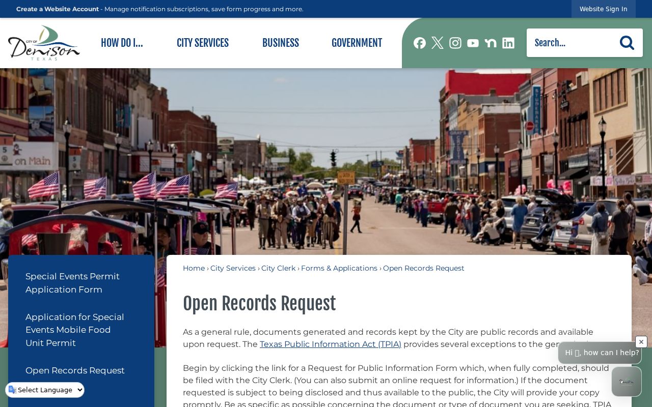
Texas Public Information Act requests can yield public records, but confidential information and protected addresses remain protected. A request should be narrow enough for the custodian to locate an existing record. For a Denison block, that means asking for the particular address and documented period, not a broad request about people.
Note: Retain the request date and the city’s response because map layers, permits, and source availability can change.
Follow Historic Denison Cemetery Leads
Fairview Cemetery can help with a historical identity question that emerges from a Denison block record, but it cannot establish who is at an address now. The public Fairview Cemetery search accepts first and last names and can return a DOI field with a Walk To Gravesite link. Pair a result with an obituary, newspaper, or directory date before treating it as evidence about an earlier household. The other five city cemeteries route through office-maintained records; a single Fairview result is not a citywide cemetery search.
The Fairview name-search page is shown below.
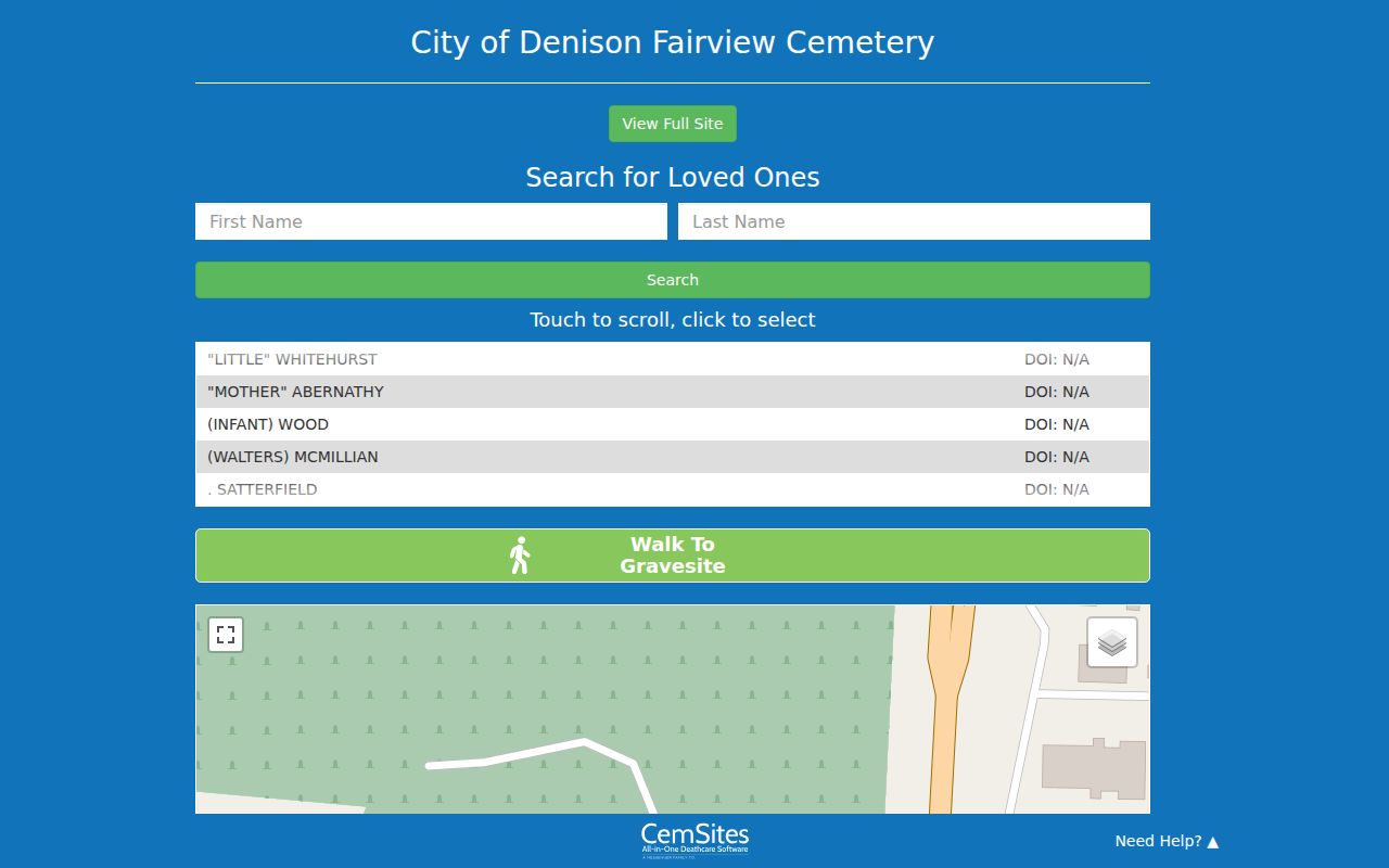
Fairview’s access details can also change. The city’s March 2026 gate and security update is shown below and notes automated and manual gate access, cameras, and the Fairview or Magnolia fence project.
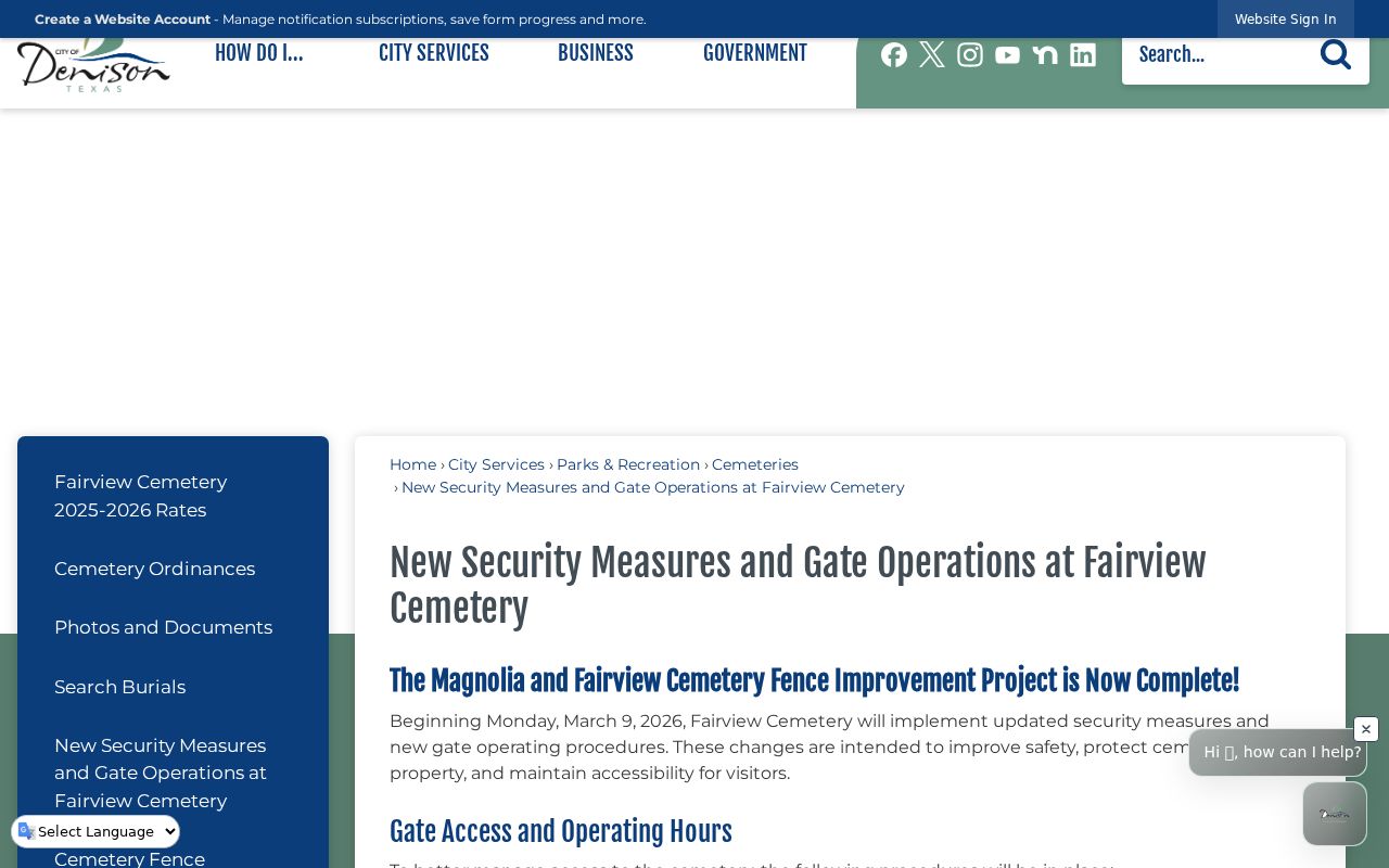
Those cemetery facts are a historical and access-channel reminder, not a block roster. The city maintains six cemeteries, and a burial or gravesite result is evidence about a person’s death or interment, not current occupancy or a current relationship with Denison neighbors.
Honor Denison Neighbor Privacy
Public land and map records have clear limits. A parcel map does not identify each person at an address. A GCAD mailing field can be outside the city. A deed proves a recorded instrument between parties, not who arrived later. Texas voter records have protected identifiers and confidentiality programs. Adoption, juvenile, sealed-court, victim, medical, financial, and protected-address information may be withheld or redacted. Do not contact, monitor, or publish information about a person merely because a Denison neighbor search surfaced a name.
Lawful use. Use Denison block records for personal, lawful research and civic context. Do not use parcel, map, or historical data to stalk, harass, intimidate, or harm anyone.
When sources disagree, keep the candidates separate and write down the record type, date, address field, and limitation. A Denison neighbor result becomes more useful when it is modest and checkable: a parcel boundary, recorded transfer, printed historical entry, or official response, each described for what it can actually show.